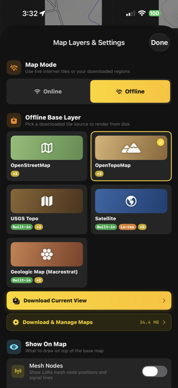
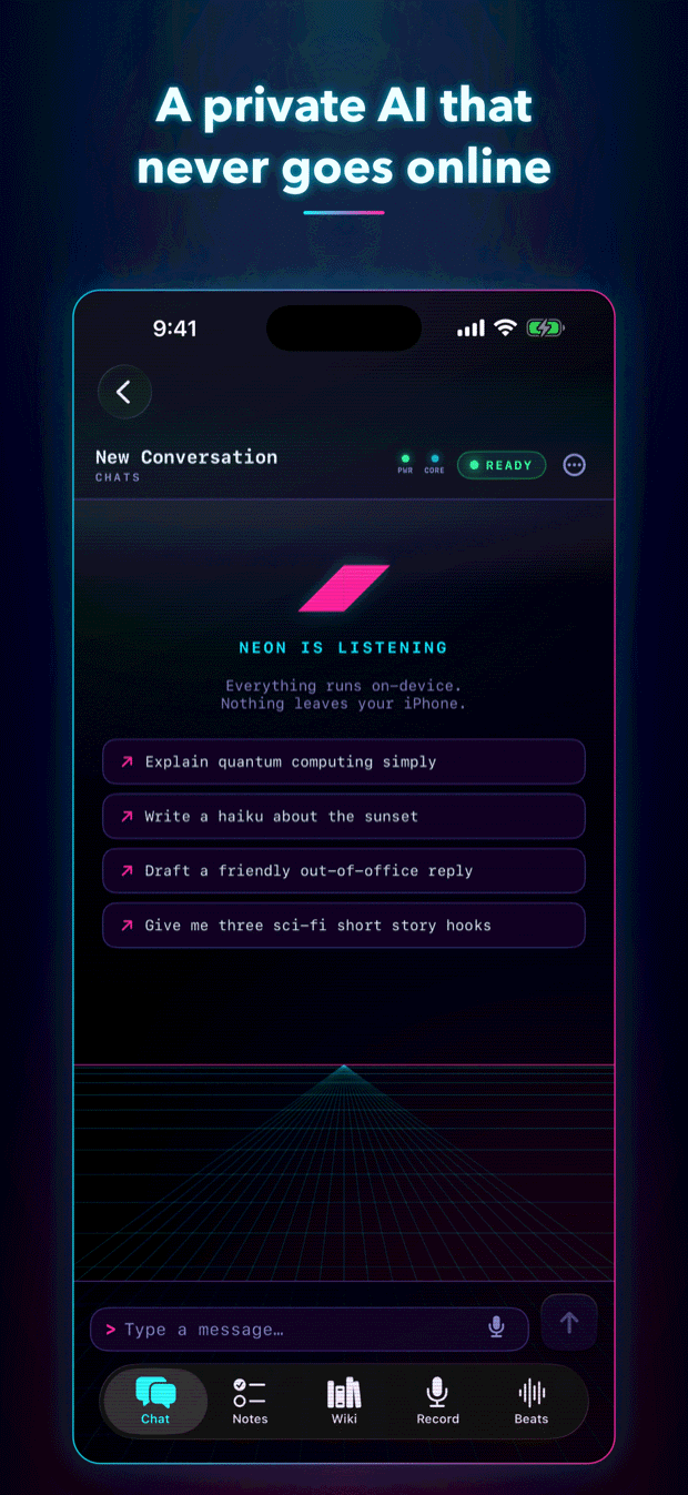
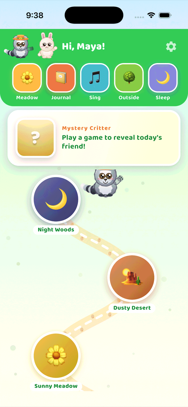
Software, AI, and aerial
intelligence built
for the field.

A veteran-owned studio building custom apps, AI integration, mesh networks, workflow automation, GIS tooling, and drone-based mapping — for clients who need things to actually work where signal ends.

Accepting Q3 work // Mountain West // FAA Part 107 // VOSB // @sc__ience
6
// disciplines
2026
// est.
2
// shipped products
// pots of coffee
// stack & capabilities · scrolling list
Swift / SwiftUI Kotlin Python TypeScript Claude API Core ML ARKit MapKit PostGIS Meshtastic LoRa BLE Pix4D Agisoft Metashape Thermal IR Orthomosaics 3D Photogrammetry FAA Part 107 n8n / Zapier pywinauto Postgres / Supabase Sentry
// what we do

Five disciplines. One team.

Most projects pull from more than one — an app that ingests drone-survey output, an AI assistant that watches gauge data, a GIS layer that ties it all to the ground beneath your feet.

Apps

Native iOS and Android, plus cross-platform when it makes sense. Offline-first, sensor-integrated, hardware-aware.

SwiftUI Kotlin RN

Automation

Custom internal tools, integrations, and pipelines that delete the spreadsheets your team hates.

Python n8n Postgres

AI

LLM-powered agents, vision models, on-device ML, and AI-assisted workflows. Used where they help — never as decoration.

Claude API Core ML Vision

GIS

Custom map applications, offline tile pipelines, geospatial analysis, geology overlays, and field-grade vector tooling.

MapKit PostGIS QGIS

Mesh Networks

Meshtastic LoRa mesh radios, MANET-style peer-to-peer comms, BLE protocol design, off-grid messaging stacks.

Meshtastic LoRa BLE

Drone

FAA Part 107 pilots flying optical, thermal, and RTK payloads. Orthomosaics, 3D models, inspections, surveys.

Thermal Ortho LiDAR
// proven capabilities

Where we've already shipped.

// industry

Oil & Gas

Mudlogging shack automation, LAS file pipelines, gauge data integration.

// drone

3D Modeling

Photogrammetry, mesh generation, dense point clouds for sites & structures.

// drone

Ortho Mapping

High-resolution orthomosaics delivered as GeoTIFF, drop-in for GIS workflows.

// drone

Thermal Imaging

Radiometric thermal mosaics for roof, solar array, and equipment inspection.

// app

GIS / Mapping

Offline-first iOS map app on the App Store, 9 layers, mesh radio integration.

// ai

AI Integration

On-device species ID, LLM agents, vision pipelines, RAG over technical docs.

// automation

UI Automation

Win32 / macOS UI automation for legacy software that lacks APIs.

// app

Native iOS

SwiftUI + SwiftData, App Store submission, ARKit, Core BLE, Core ML.

// mesh

LoRa Mesh Networks

Meshtastic integration, encrypted PSK channels, off-grid tactical messaging.

// services

Courier & Field Ops

Time-critical document & sample courier, on-site survey, Mountain West coverage.

// selected work

Things we've shipped.

Each one started as a real problem someone described over a phone call. Some became products. Some are still running quietly in the background, doing their job.

// how we work

Small team, narrow focus, real software.

We take a small number of projects at a time and stay close to them. Most engagements run 6–14 weeks to a working v1, with retainer-style maintenance after.

01 — discover

Scope & constraints

One week. We map the real workflow, the budget, and the hard edges before any code or flights.

02 — design

Prototype & pilot

Two to three weeks. Working prototype on real hardware, real data, real terrain.

03 — build

Ship the v1

Four to ten weeks. Production code, signed builds, deliverables in the format you actually use.

04 — support

Operate & evolve

Optional retainer. We fix what breaks, ship the next thing, and stay reachable when it matters.

// next step

Have a problem worth building for?

Drop a short note about what you're trying to do. We'll reply within two business days with whether we're the right fit and a rough estimate.